Iceland hiking routes map with practical trail context
DULIN shows Iceland hiking routes together with huts, waterfalls, hot pots, campsites, F-roads, regions and access context. That makes a route easier to judge before it becomes part of a real day plan.
Use the hiking map to compare trail distance, elevation gain, difficulty, road access, nearby places and backup options before committing to a route. This is especially useful for searches like Iceland hiking routes map, Iceland trail map and Iceland hikes near huts or waterfalls.
Easy
Red walking route on Hrísey.
- Region
- Northeast Iceland
- Distance
- 4.7 km
- Elevation
- 100 m
Easy
Green walking route on Hrísey.
- Region
- Northeast Iceland
- Distance
- 2.2 km
- Elevation
- 40 m
 Easy
Easy
Hiking route near Kerhólakambur 31.12.2010.
- Region
- Reykjavik
- Distance
- 0.1 km
- Elevation
- 0 m
 Moderate
Longer Kerlingarfjöll to Hveradalir hike.
- Region
- South Iceland
- Distance
- 11.5 km
- Elevation
- 540 m
 Moderate
Hiking route near Bakkagerði.
- Region
- East Iceland
- Distance
- 11.2 km
- Elevation
- 440 m
 Moderate
Hiking route near Bólstaðahlíðarrétt.
- Region
- Northwest Iceland
- Distance
- 9.9 km
- Elevation
- 340 m
 Moderate
Hiking route near Borgarvirki hringur.
- Region
- Northwest Iceland
- Distance
- 8.1 km
- Elevation
- 140 m
 Moderate
Hiking route near Heydalur, Mjóifjörður. From hotel to Ausuvatn lake and back.
- Region
- Westfjords
- Distance
- 7.7 km
- Elevation
- 430 m
Moderate
Kerlingarfjöll mountain route to Skeljafell and Kerling.
- Region
- South Iceland
- Distance
- 7 km
- Elevation
- 400 m
 Moderate
Hiking route near Kirkjufell.
- Region
- West Iceland
- Distance
- 7 km
- Elevation
- 30 m
 Moderate
Moderate mountain hike to Uppsalahnjúkur.
- Region
- Northeast Iceland
- Distance
- 4.9 km
- Elevation
- 760 m
Moderate
Short Ásgarðsfjall mountain walk.
- Region
- South Iceland
- Distance
- 4.9 km
- Elevation
- 100 m
 Moderate
Hiking route near Islandia: Stuðlagil Canyon- Stuðlafoss.
- Region
- East Iceland
- Distance
- 4.7 km
- Elevation
- 50 m
 Moderate
Hiking route near Káraborg.
- Region
- Northwest Iceland
- Distance
- 3.4 km
- Elevation
- 300 m
 Moderate
Hiking route near Husavikurfjall from Husavik.
- Region
- Northeast Iceland
- Distance
- 2.5 km
- Elevation
- 0 m
 Moderate
Hiking route near Valadalur.
- Region
- Northwest Iceland
- Distance
- 2.5 km
- Elevation
- 10 m
 Moderate
Hiking route near Varmahlíð Reykjarhóll.
- Region
- Northwest Iceland
- Distance
- 2.1 km
- Elevation
- 50 m
 Moderate
Short hot spring access hike in Kerlingarfjöll.
- Region
- South Iceland
- Distance
- 1.9 km
- Elevation
- 30 m
 Hard
Hard
285.5 km hiking route candidate near Lækjarvellir.
- Region
- Reykjanes
- Distance
- 68.5 km
- Elevation
- 1060 m
 Hard
Hard
Hiking route near Almannavegur yfir Ódáðahraun.
- Region
- Northeast Iceland
- Distance
- 62.9 km
- Elevation
- 220 m
 Hard
Hard
Hiking route near Ingólfsfjörður-Reykjafjörður.
- Region
- Westfjords
- Distance
- 58 km
- Elevation
- 1175 m
 Hard
Hard
Hiking route near Bláskógavegur trail: Húsavík to Ásbyrgi.
- Region
- Northeast Iceland
- Distance
- 50.3 km
- Elevation
- 470 m
 Hard
Hard
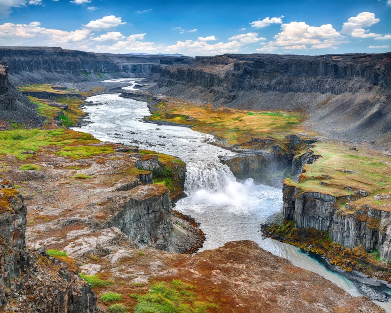
Long canyon trek linking Dettifoss and Ásbyrgi.
- Region
- North Iceland
- Distance
- 32.2 km
- Elevation
- 230 m
 Hard
Hard
Hiking route near JUN-19-10 Vesturgata.
- Region
- Westfjords
- Distance
- 27.4 km
- Elevation
- 485 m