Iceland outdoor planning guides
These guides explain how to use DULIN as a map-first planning tool for places, hikes, access context, seasons, F-roads, wildlife, lighthouses and responsible outdoor decisions.
Practical guides for using map context before choosing Iceland places, hikes and routes.
These guides explain how to use DULIN as a map-first planning tool for places, hikes, access context, seasons, F-roads, wildlife, lighthouses and responsible outdoor decisions.
Use DULIN to discover Iceland huts, shelters and remote overnight places with access notes, map filters and Premium planning details.
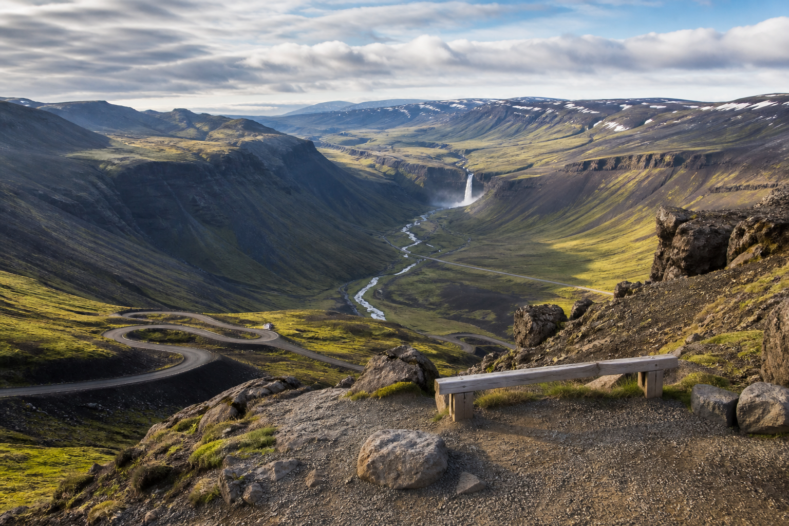
A curated map for waterfalls in Iceland, including lesser-known places away from the most crowded stops.
Explore Iceland hiking routes with distance, elevation, region and difficulty context.
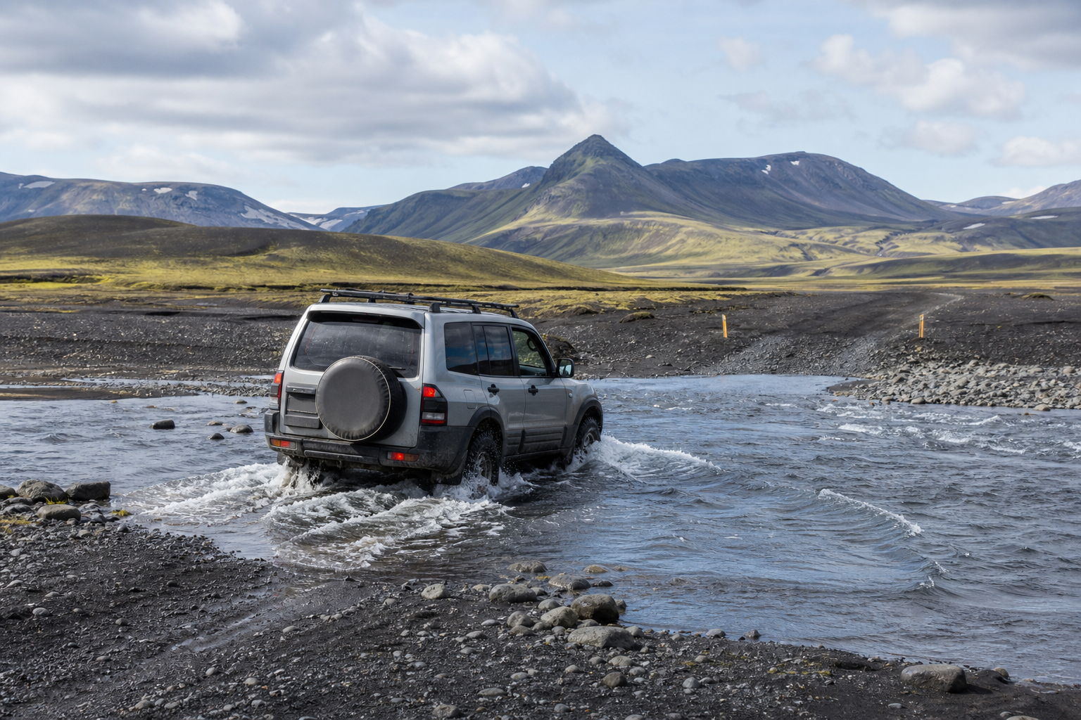
Understand where river crossings, F-roads and highland access can affect outdoor planning in Iceland.
Find natural hot pots, pools and geothermal stops on an Iceland map with nearby outdoor context.
Plan an Iceland trip around real geography: hidden places, huts, waterfalls, hot pots, hikes, roads and weather context.
Build a hiking-focused Iceland trip with routes, elevation, access notes, nearby places and map filters.
Discover lesser-known outdoor places in Iceland without losing the practical planning context.
A practical Iceland outdoor map combining hidden places, hiking routes, waterfalls, hot pots, huts and access context.
Use a hiking-first Iceland map with routes, elevation, technical difficulty, river crossing context and nearby outdoor places.
Find mountain huts, emergency shelters and lodge-style overnight places in Iceland with practical access context.
Plan Iceland hot springs and hot pots with nearby places, access notes and responsible outdoor context.
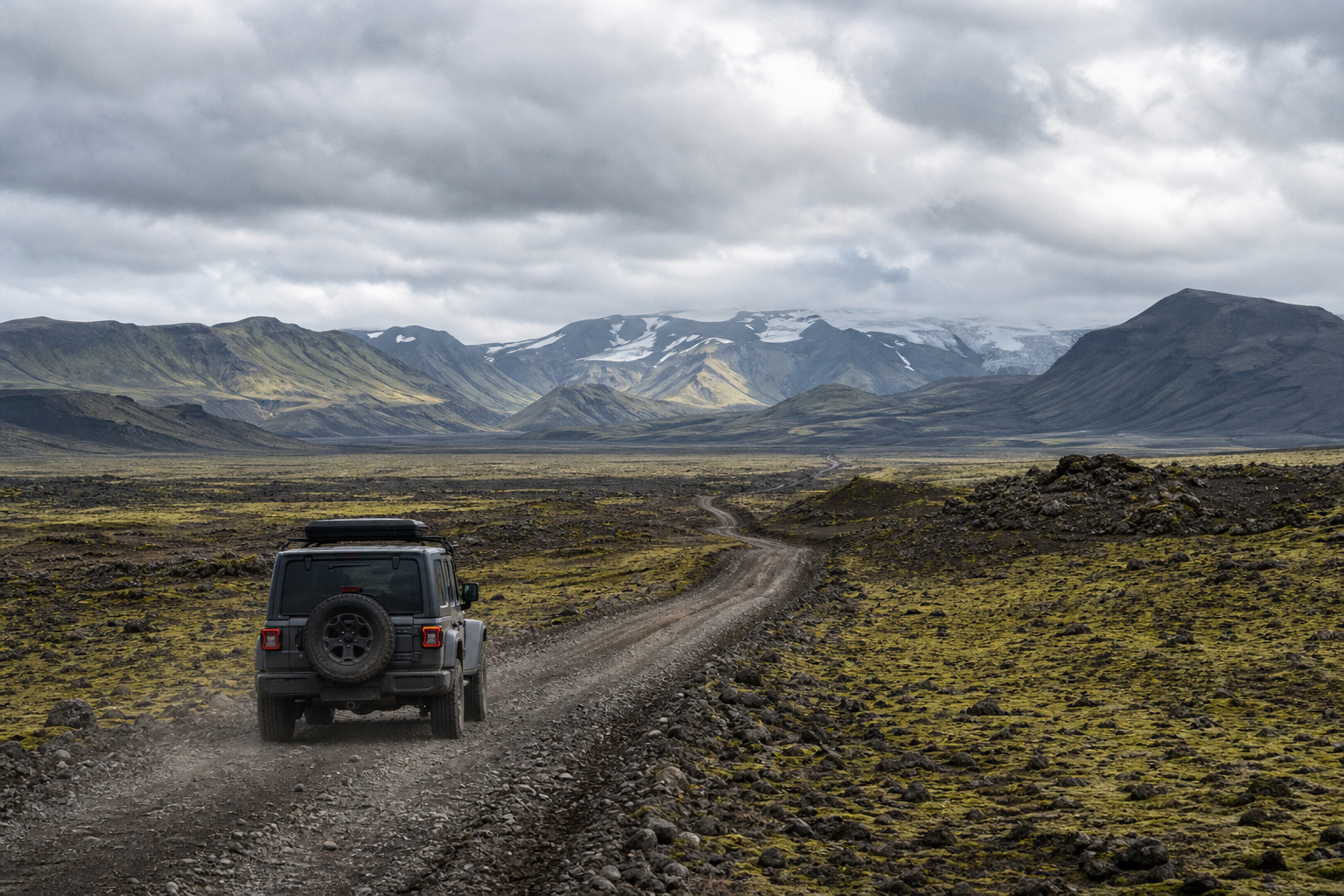
Plan around Iceland F-roads, highland access and possible river crossings before choosing remote places or routes.
Discover lesser-known Iceland waterfalls and combine them with nearby routes, huts, hot pots and road context.
Plan an Iceland road trip around waterfalls, huts, hot pots, hikes, F-roads and hidden places instead of isolated tourist lists.
Use DULIN to compare highland places, hiking routes, F-road access, river-crossing context and seasonal planning signals.
Think about Iceland seasons, daylight, roads, river crossings and weather before choosing hidden places or hiking routes.
Plan Iceland waterfalls by region, road access and nearby outdoor context instead of chasing disconnected famous stops.
Use natural hot pots in Iceland responsibly by checking access, privacy, facilities, crowding and nearby alternatives.
Understand the difference between mountain huts, emergency shelters, private huts and overnight planning records in Iceland.
Plan Iceland Highland drives with F-road access, river-crossing signals, weather exposure and conservative backup options.
Find Iceland golf courses and outdoor sport places in DULIN with nearby routes, road context and regional trip planning signals.
Find Iceland viewpoints, scenic overlooks and roadside lookouts with access, safety and nearby route context in DULIN.
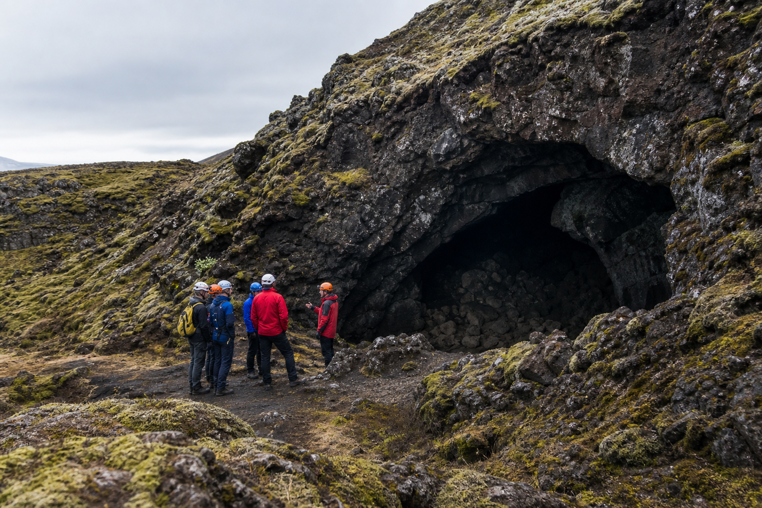
Use Iceland cave records as planning context only: caves can be life-threatening and should normally be visited with a qualified guide.
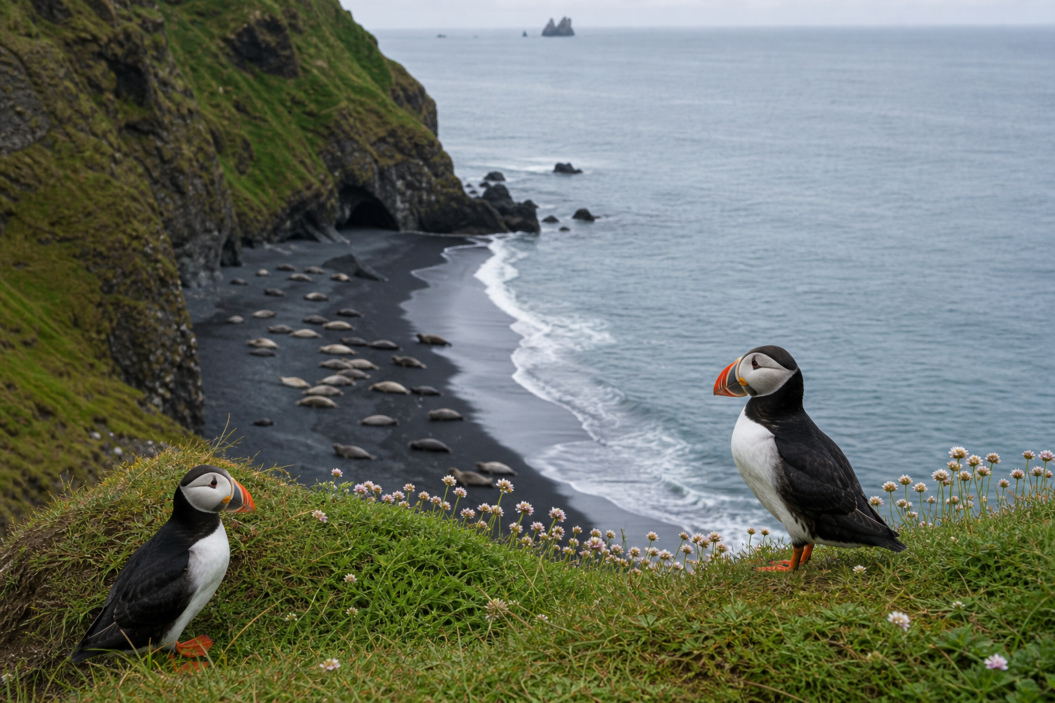
Find Iceland wildlife watching places in DULIN with seasonal context, safe distance reminders and nearby route planning.
Plan Iceland puffin watching with coastal access, season, safe viewing distance and nearby outdoor context.
Plan Iceland seal watching stops with beach access, tide-aware caution, safe distance and nearby route context.
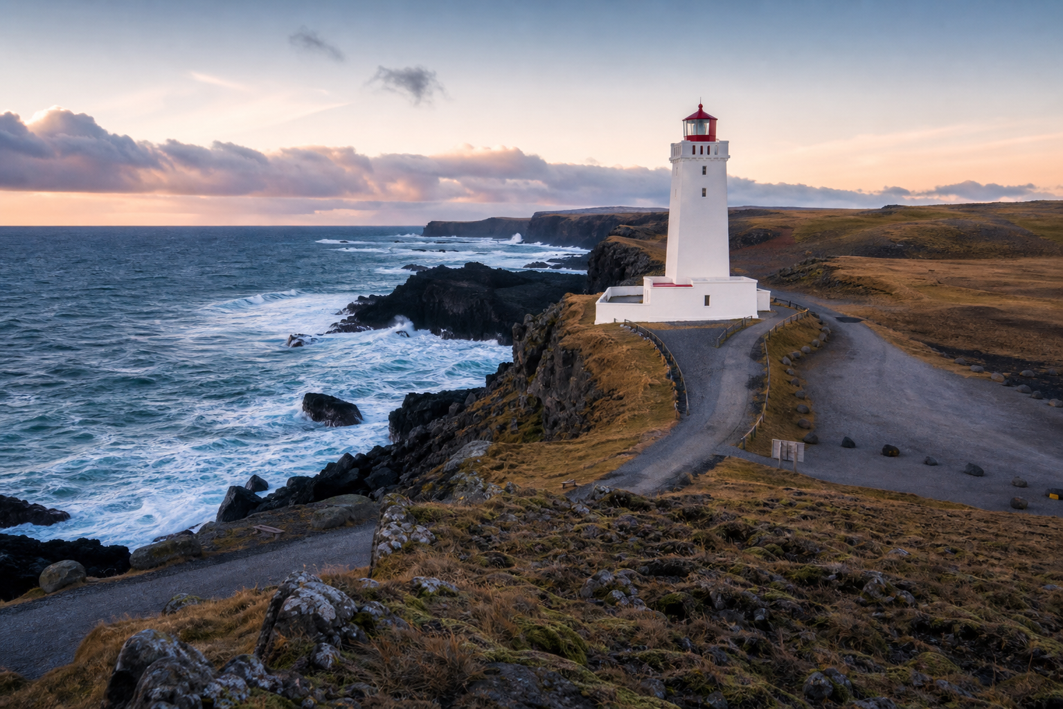
Find Iceland lighthouses and coastal viewpoints with road access, nearby places and weather-aware route planning.
Plan drone flights in Iceland with current rules, protected-area restrictions, no-fly checks and DULIN drone access signals for outdoor places.