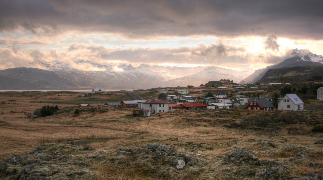
Plan East Iceland by nearby context
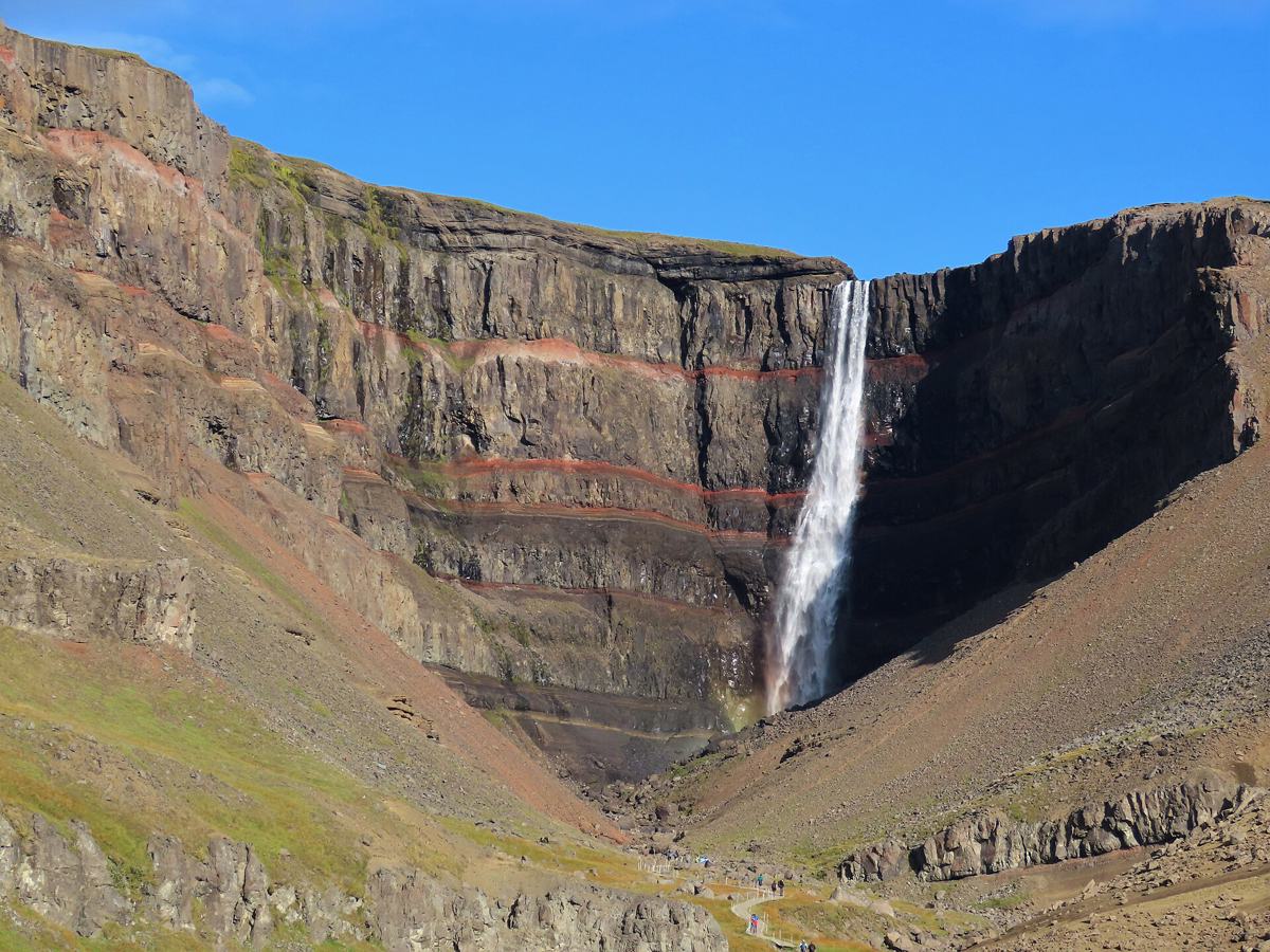
East Iceland rewards slower travel: fjords, waterfalls, quiet valleys and hiking routes where road access and weather can change the day.
East Iceland is a region where the map matters. Distances can look modest, but fjords, mountain roads and weather often decide how much you can realistically do in a day. Waterfalls, quiet valleys and route options are strongest when grouped around a base rather than added as scattered detours.
Use DULIN here to connect waterfalls, huts, hot pots and hikes with access context. Keep backup stops in the same fjord or valley and check wind, visibility and gravel-road conditions before committing to remote places.
 Hut
Hut
Sigurðarskáli í Kverkfjöllum - Ferðafélag Fljótsdalshéraðs is a mountain hut or lodge in Múlaþing, East Iceland. road access is classified as four wheel...
- Region
- East Iceland
- Road
- Four Wheel Drive
- Season
- Unknown
 Waterfall
Fossardafoss is a waterfall in Múlaþing, East Iceland. road access is classified as car.
- Region
- East Iceland
- Road
- Car
- Season
- Year Round
 Waterfall
Gljúfursárfoss is a waterfall in Vopnafjarðarhreppur, East Iceland. road access is classified as car.
- Region
- East Iceland
- Road
- Car
- Season
- Year Round
 Waterfall
Hundafoss is a waterfall in Sveitarfélagið Hornafjörður, East Iceland. road access is classified as car. it lies in or near protected area data: Vatnajö...
- Region
- East Iceland
- Road
- Car
- Season
- Year Round
 Waterfall
Fardagafoss is a waterfall in Múlaþing, East Iceland. road access is classified as foot only.
- Region
- East Iceland
- Road
- Foot Only
- Season
- Year Round
 Waterfall
Folaldafoss is a waterfall in Múlaþing, East Iceland. road access is classified as likely foot access.
- Region
- East Iceland
- Road
- Likely Foot Access
- Season
- Year Round
 Waterfall
Gljúfrasmiður is a waterfall in Múlaþing, East Iceland. road access is classified as likely foot access. it lies in or near protected area data: Vatnajö...
- Region
- East Iceland
- Road
- Likely Foot Access
- Season
- Year Round
 Waterfall
Gufufoss is a waterfall in Múlaþing, East Iceland. road access is classified as likely foot access.
- Region
- East Iceland
- Road
- Likely Foot Access
- Season
- Year Round
 Waterfall
Hengifoss is a waterfall in Fljótsdalshreppur, East Iceland. road access is classified as foot only.
- Region
- East Iceland
- Road
- Foot Only
- Season
- Year Round
 Waterfall
Kirkjufoss is a waterfall in Fljótsdalshreppur, East Iceland. road access is classified as foot only.
- Region
- East Iceland
- Road
- Foot Only
- Season
- Year Round
 Waterfall
Litlanesfoss is a waterfall in Fljótsdalshreppur, East Iceland. road access is classified as foot only.
- Region
- East Iceland
- Road
- Foot Only
- Season
- Year Round
 Waterfall
Morsárfoss is a waterfall in Sveitarfélagið Hornafjörður, East Iceland. road access is classified as foot only. it lies in or near protected area data: ...
- Region
- East Iceland
- Road
- Foot Only
- Season
- Year Round
 Moderate
Hiking route near Bakkagerði.
- Region
- East Iceland
- Distance
- 11.2 km
- Elevation
- 440 m
 Moderate
Hiking route near Islandia: Stuðlagil Canyon- Stuðlafoss.
- Region
- East Iceland
- Distance
- 4.7 km
- Elevation
- 50 m
 Very Hard
Remote multi-day trek from Snæfell into Lónsöræfi.
- Region
- East Iceland
- Distance
- 70.7 km
- Elevation
- 1610 m
 Very Hard
Remote Eastfjords trek through Brúnavík, Húsavík and Loðmundarfjörður.
- Region
- East Iceland
- Distance
- 59.6 km
- Elevation
- 2040 m
 River Crossing
56.5 km hiking route candidate near Magnúsarfoss.
- Region
- East Iceland
- Distance
- 30 km
- Elevation
- 2075 m
 River Crossing
14.6 km hiking route candidate near Bræðrabúð.
- Region
- East Iceland
- Distance
- 18.4 km
- Elevation
- 825 m
River Crossing
64.0 km hiking route candidate near Brúnavík.
- Region
- East Iceland
- Distance
- 17 km
- Elevation
- 815 m
 River Crossing
53.2 km hiking route candidate near Magnúsarfoss.
- Region
- East Iceland
- Distance
- 15.5 km
- Elevation
- 690 m
 Scramble
Hiking route near Vestrahorn, Iceland.
- Region
- East Iceland
- Distance
- 15.2 km
- Elevation
- 415 m
 River Crossing
54.5 km hiking route candidate near Magnúsarfoss.
- Region
- East Iceland
- Distance
- 15 km
- Elevation
- 190 m
Scramble
23.9 km hiking route candidate near Waterfall.
- Region
- East Iceland
- Distance
- 8.9 km
- Elevation
- 1425 m
River Crossing
32.3 km hiking route candidate near Sandvík.
- Region
- East Iceland
- Distance
- 8.8 km
- Elevation
- 580 m