Culture
Vesturfarasetrið is a cultural place in Iceland, classified as museum. Opening hours, ticket prices and access can change; verify locally before visiting.
- Region
- Northwest Iceland
- Road
- Car
- Season
- Year Round
Culture
Ystafell Transporation museum is a cultural place in Iceland, classified as museum. Opening hours, ticket prices and access can change; verify locally b...
- Region
- Northeast Iceland
- Road
- Car
- Season
- Year Round
Lighthouse
Æðarsteinn is mapped as a lighthouse in OpenStreetMap. Seamark classification: light_minor. Visitor access, opening and drone rules should be checked lo...
- Region
- East Iceland
- Road
- Likely Foot Access
- Season
- Year Round
Lighthouse
Brimnes is mapped as a lighthouse in OpenStreetMap. Seamark classification: light_minor. Visitor access, opening and drone rules should be checked locally.
- Region
- East Iceland
- Road
- Four Wheel Drive
- Season
- Year Round
Lighthouse
Elliðaey is mapped as a lighthouse in OpenStreetMap. Seamark classification: light_minor. Visitor access, opening and drone rules should be checked loca...
- Region
- West Iceland
- Road
- Foot Only
- Season
- Year Round
Wildlife
Harbour seal (Phoca vitulina) haul-out site. Latest non-negative count in source attributes: 366 (2018). Mapped area: 62 ha. Public site-level point der...
- Region
- East Iceland
- Road
- Foot Only
- Season
- Seasonal
Wildlife
Harbour seal (Phoca vitulina) haul-out site. Latest non-negative count in source attributes: 2 (2018). Mapped area: 58 ha. Public site-level point deriv...
- Region
- Unknown
- Road
- Foot Only
- Season
- Seasonal
Lighthouse
Gerðistangi is mapped as a lighthouse in OpenStreetMap. Seamark classification: light_minor. Visitor access, opening and drone rules should be checked l...
- Region
- Reykjanes
- Road
- Likely Foot Access
- Season
- Year Round
Lighthouse
Grímsey á Steingrímsfirði is mapped as a lighthouse in OpenStreetMap. Seamark classification: light_minor. Visitor access, opening and drone rules shoul...
- Region
- Westfjords
- Road
- Foot Only
- Season
- Year Round
Lighthouse
Hafnarnes is mapped as a lighthouse in OpenStreetMap. Seamark classification: light_minor. Visitor access, opening and drone rules should be checked loc...
- Region
- East Iceland
- Road
- Likely Foot Access
- Season
- Year Round
Lighthouse
Hópsnes is mapped as a lighthouse in OpenStreetMap. Seamark classification: light_minor. Visitor access, opening and drone rules should be checked locally.
- Region
- Reykjanes
- Road
- Car
- Season
- Year Round
Lighthouse
Hornafjörður is mapped as a lighthouse in OpenStreetMap. Seamark classification: light_minor. Visitor access, opening and drone rules should be checked ...
- Region
- East Iceland
- Road
- Four Wheel Drive
- Season
- Year Round
Lighthouse
Höskuldsey is mapped as a lighthouse in OpenStreetMap. Seamark classification: light_minor. Visitor access, opening and drone rules should be checked lo...
- Region
- West Iceland
- Road
- Foot Only
- Season
- Year Round
Wildlife
Harbour seal (Phoca vitulina) haul-out site. Latest non-negative count in source attributes: 29 (2018). Mapped area: 49 ha. Public site-level point deri...
- Region
- Unknown
- Road
- Foot Only
- Season
- Seasonal
Lighthouse
Karlsstaðatangi is mapped as a lighthouse in OpenStreetMap. Seamark classification: light_minor. Visitor access, opening and drone rules should be check...
- Region
- East Iceland
- Road
- Likely Foot Access
- Season
- Year Round
Lighthouse
Kögur is mapped as a lighthouse in OpenStreetMap. Seamark classification: light_minor. Visitor access, opening and drone rules should be checked locally.
- Region
- East Iceland
- Road
- Foot Only
- Season
- Year Round
Wildlife
Harbour seal (Phoca vitulina) haul-out site. Latest non-negative count in source attributes: 2 (2018). Mapped area: 15 ha. Public site-level point deriv...
- Region
- Unknown
- Road
- Foot Only
- Season
- Seasonal
Lighthouse
Krossvíkurviti is mapped as a lighthouse in OpenStreetMap. Seamark classification: light_minor. Visitor access, opening and drone rules should be checke...
- Region
- West Iceland
- Road
- Car
- Season
- Year Round
Lighthouse
Málmey is mapped as a lighthouse in OpenStreetMap. Seamark classification: light_minor. Visitor access, opening and drone rules should be checked locally.
- Region
- Northwest Iceland
- Road
- Four Wheel Drive
- Season
- Year Round
Lighthouse
Mánáreyjar is mapped as a lighthouse in OpenStreetMap. Seamark classification: light_minor. Visitor access, opening and drone rules should be checked lo...
- Region
- Northeast Iceland
- Road
- Foot Only
- Season
- Year Round
Lighthouse
Melrakkanes is mapped as a lighthouse in OpenStreetMap. Seamark classification: light_minor. Visitor access, opening and drone rules should be checked l...
- Region
- Northeast Iceland
- Road
- Foot Only
- Season
- Year Round
Lighthouse
Norðfjarðarhorn is mapped as a lighthouse in OpenStreetMap. Seamark classification: light_minor. Visitor access, opening and drone rules should be check...
- Region
- East Iceland
- Road
- Foot Only
- Season
- Year Round
Wildlife
Harbour seal (Phoca vitulina) haul-out site. Latest non-negative count in source attributes: 60 (2018). Mapped area: 33 ha. Public site-level point deri...
- Region
- Unknown
- Road
- Four Wheel Drive
- Season
- Seasonal
Wildlife
Harbour seal (Phoca vitulina) haul-out site. Latest non-negative count in source attributes: 3 (2018). Mapped area: 41 ha. Public site-level point deriv...
- Region
- South Iceland
- Road
- Foot Only
- Season
- Seasonal
Lighthouse
Öndverðarnes is mapped as a lighthouse in OpenStreetMap. Seamark classification: light_minor. Visitor access, opening and drone rules should be checked ...
- Region
- West Iceland
- Road
- Car
- Season
- Year Round
Lighthouse
Papey is mapped as a lighthouse in OpenStreetMap. Seamark classification: light_minor. Visitor access, opening and drone rules should be checked locally.
- Region
- East Iceland
- Road
- Foot Only
- Season
- Year Round
Lighthouse
Raufarhafnarviti is mapped as a lighthouse in OpenStreetMap. Seamark classification: light_minor. Visitor access, opening and drone rules should be chec...
- Region
- Northeast Iceland
- Road
- Car
- Season
- Year Round
Wildlife
Harbour seal (Phoca vitulina) haul-out site. Latest non-negative count in source attributes: 0 (2018). Mapped area: 1 ha. Public site-level point derive...
- Region
- Unknown
- Road
- Car
- Season
- Seasonal
Lighthouse
Selskersviti is mapped as a lighthouse in OpenStreetMap. Seamark classification: light_minor. Visitor access, opening and drone rules should be checked ...
- Region
- Westfjords
- Road
- Foot Only
- Season
- Year Round
Lighthouse
Selvíkurnef is mapped as a lighthouse in OpenStreetMap. Seamark classification: light_minor. Visitor access, opening and drone rules should be checked l...
- Region
- Northeast Iceland
- Road
- Foot Only
- Season
- Year Round
Lighthouse
Selvogsviti is mapped as a lighthouse in OpenStreetMap. Seamark classification: light_minor. Visitor access, opening and drone rules should be checked l...
- Region
- South Iceland
- Road
- Foot Only
- Season
- Year Round
Wildlife
Grey seal (Halichoerus grypus) haul-out site. Latest non-negative count in source attributes: 2 (2017). Mapped area: 14 ha. Public site-level point deri...
- Region
- Northwest Iceland
- Road
- Foot Only
- Season
- Seasonal
Wildlife
Grey seal (Halichoerus grypus) haul-out site. Latest non-negative count in source attributes: 1077 (2017). Mapped area: 181 ha. Public site-level point ...
- Region
- Unknown
- Road
- Four Wheel Drive
- Season
- Seasonal
Wildlife
Grey seal (Halichoerus grypus) haul-out site. Latest non-negative count in source attributes: 99 (2017). Mapped area: 75 ha. Public site-level point der...
- Region
- Unknown
- Road
- Four Wheel Drive
- Season
- Seasonal
Wildlife
Harbour seal (Phoca vitulina) haul-out site. Latest non-negative count in source attributes: 0 (2018). Mapped area: 20 ha. Public site-level point deriv...
- Region
- West Iceland
- Road
- Foot Only
- Season
- Seasonal
Lighthouse
Skor is mapped as a lighthouse in OpenStreetMap. Seamark classification: light_minor. Visitor access, opening and drone rules should be checked locally.
- Region
- Westfjords
- Road
- Foot Only
- Season
- Year Round
Lighthouse
Stafnes is mapped as a lighthouse in OpenStreetMap. Seamark classification: light_minor. Visitor access, opening and drone rules should be checked locally.
- Region
- Reykjanes
- Road
- Car
- Season
- Year Round
Lighthouse
Straumnesviti is mapped as a lighthouse in OpenStreetMap. Seamark classification: light_minor. Visitor access, opening and drone rules should be checked...
- Region
- Westfjords
- Road
- Four Wheel Drive
- Season
- Year Round
Lighthouse
Streiti is mapped as a lighthouse in OpenStreetMap. Seamark classification: light_minor. Visitor access, opening and drone rules should be checked locally.
- Region
- East Iceland
- Road
- Four Wheel Drive
- Season
- Year Round
 Lighthouse
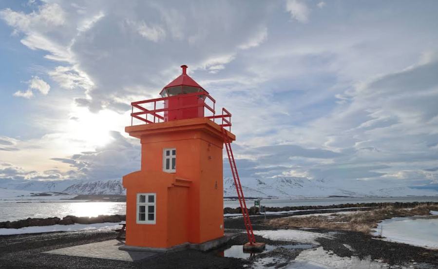
Svalbarðseyri is mapped as a lighthouse in OpenStreetMap. Seamark classification: light_minor. Visitor access, opening and drone rules should be checked...
- Region
- Northeast Iceland
- Road
- Car
- Season
- Year Round
Lighthouse
Svörtuloft is mapped as a lighthouse in OpenStreetMap. Seamark classification: light_minor. Visitor access, opening and drone rules should be checked lo...
- Region
- West Iceland
- Road
- Likely Foot Access
- Season
- Year Round
Lighthouse
Taska is mapped as a lighthouse in OpenStreetMap. Seamark classification: light_minor. Visitor access, opening and drone rules should be checked locally.
- Region
- Unknown
- Road
- Likely Foot Access
- Season
- Year Round
Wildlife
Grey seal (Halichoerus grypus) haul-out site. Latest non-negative count in source attributes: 146 (2017). Mapped area: 1 ha. Public site-level point der...
- Region
- Unknown
- Road
- Four Wheel Drive
- Season
- Seasonal
Lighthouse
Þorlákshöfn is mapped as a lighthouse in OpenStreetMap. Seamark classification: light_minor. Visitor access, opening and drone rules should be checked l...
- Region
- South Iceland
- Road
- Likely Foot Access
- Season
- Year Round
Lighthouse
Þormóðssker is mapped as a lighthouse in OpenStreetMap. Seamark classification: light_minor. Visitor access, opening and drone rules should be checked l...
- Region
- West Iceland
- Road
- Foot Only
- Season
- Year Round
Wildlife
Grey seal (Halichoerus grypus) haul-out site. Latest non-negative count in source attributes: 0 (2017). Mapped area: 1 ha. Public site-level point deriv...
- Region
- Unknown
- Road
- Four Wheel Drive
- Season
- Seasonal
Wildlife
Harbour seal (Phoca vitulina) haul-out site. Latest non-negative count in source attributes: 2 (2018). Mapped area: 1 ha. Public site-level point derive...
- Region
- Unknown
- Road
- Foot Only
- Season
- Seasonal
Sport
Akranes is listed in the DULIN catalogue under climbing. Its recorded location is in Hvalfjarðarsveit, West Iceland. The local elevation model estimates...
- Region
- West Iceland
- Road
- Unknown
- Season
- Unknown
Sport
Ásvellir is listed in the DULIN catalogue under climbing. Its recorded location is in Hafnarfjarðarkaupstaður, Reykjanes. The local elevation model esti...
- Region
- Reykjanes
- Road
- Unknown
- Season
- Unknown
Campsite
Bjarg is listed in the DULIN catalogue under campsites. Its recorded location is in Þingeyjarsveit, Northeast Iceland. The local elevation model estimat...
- Region
- Northeast Iceland
- Road
- Unknown
- Season
- Unknown
Sport
A 12.5 m indoor teaching pool at Laugabraut 6, with an outdoor hot tub. Public sessions are offered on winter weekends; private rental is also available...
- Region
- West Iceland
- Road
- Unknown
- Season
- Winter Season
Sport
A small farm pool associated with the guesthouse, cabins and campsite at Djupidalur in the Westfjords. Facilities include small swimming pool, hot tubs.
- Region
- Westfjords
- Road
- Unknown
- Season
- Unknown
Sport
An indoor swimming pool in the municipal sports centre by Vorda in Djupivogur, with a steam bath and children's bathing facilities. Facilities include s...
- Region
- East Iceland
- Road
- Unknown
- Season
- Unknown
Sport
Fallastakkanöf is listed in the DULIN catalogue under climbing. Its recorded location is in Sveitarfélagið Hornafjörður, East Iceland. The local elevati...
- Region
- East Iceland
- Road
- Unknown
- Season
- Unknown
Campsite
Farmhouse Lodge - Skeiðflöt is listed in the DULIN catalogue under campsites. Its recorded location is in Mýrdalshreppur, South Iceland. The local eleva...
- Region
- South Iceland
- Road
- Unknown
- Season
- Unknown
Sport
Fjallsárlón is listed in the DULIN catalogue under climbing. Its recorded location is in Sveitarfélagið Hornafjörður, East Iceland. The local elevation ...
- Region
- East Iceland
- Road
- Unknown
- Season
- Unknown
Sport
A shallow 6 x 12 m outdoor pool beside the holiday cottages at Flokalundur. Access is restricted to cottage guests and the pool operates in summer. Faci...
- Region
- Westfjords
- Road
- Unknown
- Season
- Summer Season
Sport
Geldinganes is listed in the DULIN catalogue under climbing. Its recorded location is in Reykjavíkurborg, Reykjavik. The local elevation model estimates...
- Region
- Reykjavik
- Road
- Unknown
- Season
- Unknown
Sport
Gerðuberg is listed in the DULIN catalogue under climbing. Its recorded location is in Eyja- og Miklaholtshreppur, West Iceland. The local elevation mod...
- Region
- West Iceland
- Road
- Unknown
- Season
- Unknown
Sport
A 25 m outdoor pool beside the campsite at Reykholar, operating in summer. This is not Grettislaug at Reykir near Saudarkrokur. Facilities include 25 m ...
- Region
- Westfjords
- Road
- Unknown
- Season
- Summer Season