Plan Westfjords by nearby context
The Westfjords are slower, remote and highly rewarding when you plan around long drives, fjords, gravel roads and backup stops.
The Westfjords reward patient travel. Roads are slower, fjords stretch the driving time, and the best outdoor stops often make sense only when they are already near your route. This is a region where fewer, better-chosen stops usually win.
Use DULIN to group waterfalls, huts, route ideas and campsites by area. Keep an eye on road surfaces, wind and daylight, and avoid planning a day that depends on too many long fjord detours.
Treat driving commitment as part of the attraction
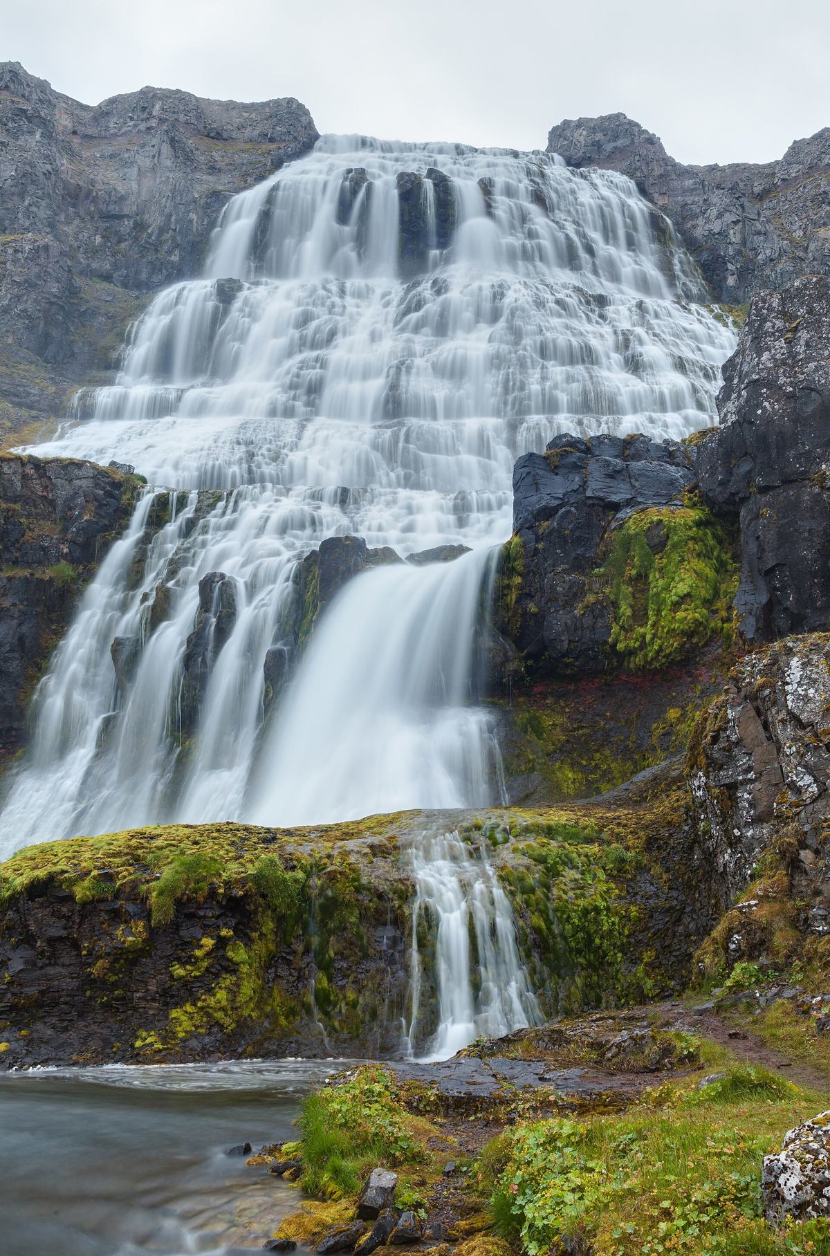
A Dynjandi visit, a remote bird-cliff outing and a town day are not interchangeable stops. Choose the main objective and the actual road connection first. Keep a lower-commitment plan that does not require another long exposed drive.
Detailed planning comparison | Other regions
Regional groups follow the source records and can overlap travel areas. Counts describe available public records, not complete visitor coverage. Check road conditions and current travel notices before departure.
What the DULIN data currently covers in Westfjords
The public regional index currently contains 86 places and 5 hikes. The strongest place groups are Waterfall (31), Campsite (15), Lighthouse (10), Culture (8), Wildlife (8). Counts describe database coverage, not quality rankings or guaranteed access.
Place starting points: Hlöðuvík, Goðafoss, Dynjandi, Bænahúsfoss.
Hike starting points: Reykjafjörður, Hornstrandir: Hesteyri - Látrar Aðalvík, Hornstrandir: Hesteyri - Sæból Aðalvík, Vaðalfjöll.
Use these names to build a compact shortlist, then remove any option whose current road, weather, season or safety context does not fit the day.
Hut
Hlöðuvík is a emergency shelter or refuge in Ísafjarðarbær, Westfjords. road access is classified as foot only. it lies in or near protected area data: ...
- Region
- Westfjords
- Road
- Foot Only
- Season
- Unknown
 Waterfall
Goðafoss is a waterfall in Kaldrananeshreppur, Westfjords. road access is classified as foot only.
- Region
- Westfjords
- Road
- Foot Only
- Season
- Year Round
Waterfall
Dynjandi is a waterfall in Ísafjarðarbær, Westfjords. road access is classified as foot only.
- Region
- Westfjords
- Road
- Foot Only
- Season
- Year Round
Waterfall
Bænahúsfoss is a waterfall in Reykhólahreppur, Westfjords. road access is classified as likely foot access.
- Region
- Westfjords
- Road
- Likely Foot Access
- Season
- Year Round
Waterfall
Djúpavíkurfoss is a waterfall in Árneshreppur, Westfjords. road access is classified as likely foot access.
- Region
- Westfjords
- Road
- Likely Foot Access
- Season
- Year Round
Waterfall
Heyárfoss is a waterfall in Reykhólahreppur, Westfjords. road access is classified as foot only.
- Region
- Westfjords
- Road
- Foot Only
- Season
- Year Round
Waterfall
Rjúkandisfoss is a waterfall in Árneshreppur, Westfjords. road access is classified as foot only.
- Region
- Westfjords
- Road
- Foot Only
- Season
- Year Round
Waterfall
Staðarfoss is a waterfall in Reykhólahreppur, Westfjords. road access is classified as foot only.
- Region
- Westfjords
- Road
- Foot Only
- Season
- Year Round
Waterfall
Foss is a waterfall in Vesturbyggð, Westfjords. road access is classified as car.
- Region
- Westfjords
- Road
- Car
- Season
- Year Round
Waterfall
Laugufoss is a waterfall in Strandabyggð, Westfjords. road access is classified as car.
- Region
- Westfjords
- Road
- Car
- Season
- Year Round
Waterfall
Àlftafoss is a waterfall in Strandabyggð, Westfjords. road access is classified as foot only.
- Region
- Westfjords
- Road
- Foot Only
- Season
- Year Round
Waterfall
Bakkafoss is a waterfall in Reykhólahreppur, Westfjords. road access is classified as foot only.
- Region
- Westfjords
- Road
- Foot Only
- Season
- Year Round
 Hard
Hard
Hiking route imported from an anonymized Wikiloc GPX candidate and recalculated against DULIN project data. Distance, elevation profile, mobile coverage...
- Region
- Westfjords
- Distance
- 58 km
- Elevation
- 1175 m
 Scramble
Official Hornstrandir hiking route from Hesteyri to Látrar in Aðalvík via Hesteyrarskarð. Old visible route with a river crossing at Stakkadalsós.
- Region
- Westfjords
- Distance
- 20.4 km
- Elevation
- 730 m
 River Crossing
Official Hornstrandir hiking route from Hesteyri to Sæból in Aðalvík via Sléttuheiði. Marked remote route with a river crossing and wet ground sections.
- Region
- Westfjords
- Distance
- 13.7 km
- Elevation
- 300 m
 Scramble
Mountain hike to Vaðalfjöll. Distinctive summit area and views over Breiðafjörður. Distance, elevation, slope, mobile coverage and nearby context were c...
- Region
- Westfjords
- Distance
- 3.5 km
- Elevation
- 385 m
Scramble
Helluvatn: the stored OSM-derived track measures 2.9 km in the current DULIN geometry. This is the mapped track length, not confirmation of a complete v...
- Region
- Westfjords
- Distance
- 2.9 km
- Elevation
- 285 m